
Skip to content
Maryland AuthorityMARYLAND
AUTHORITY
Menu

Maryland communities

City of Annapolis

Annapolis brings together the State House, downtown streets and the maritime setting of Eastport. Explore its separate pockets on foot and by local transit, with attention to the creek crossings and your destination’s entrance.

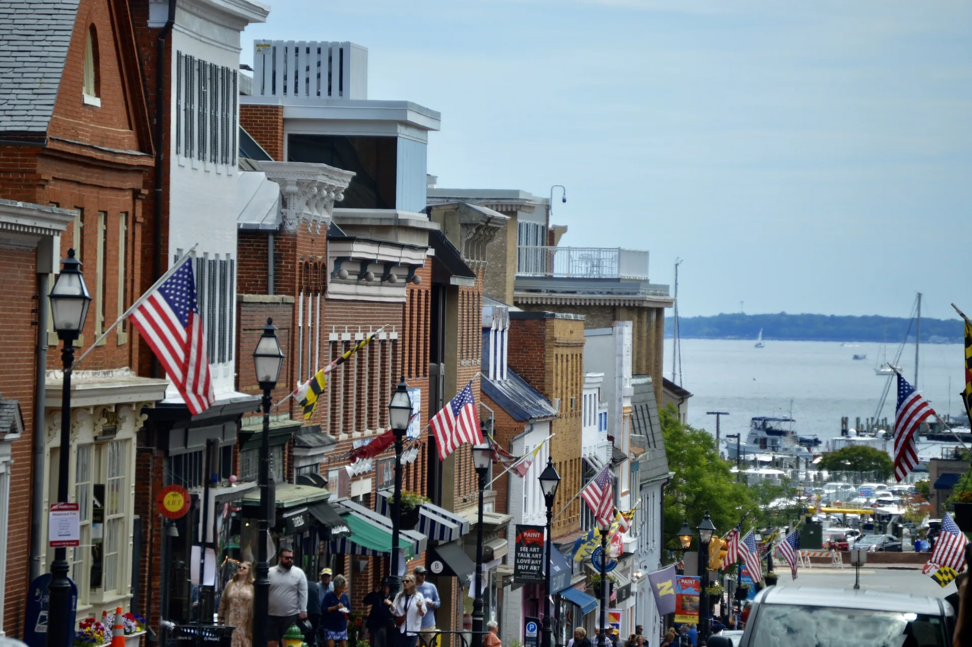
Main Street in Annapolis descending toward the harbor.

Annapolis is best understood in smaller pieces. Around State Circle and Maryland Avenue, the Maryland State House and the legislative complex put state government into the downtown street scene. Main Street and Market Space draw you toward the waterfront, while Eastport opens another side of the city.

The Annapolis Maritime Museum & Park is a useful Eastport landmark. Its museum is at the Back Creek end of Second Street; its separate park campus is on Edgewood Road across the creek. Choose the correct campus before leaving, because two waterfront locations can be close across the water and require a different trip by road.

Forest Drive and Bay Ridge Avenue are part of the road approach to this side of Annapolis. Downtown, the city’s trolley information helps you compare garage locations and the streets served. Construction can change the route, so use the city’s current map when planning that leg of a visit.

Leave room to learn one area at a time. An errand near Maryland Avenue, a walk around downtown and a visit to Back Creek need not all be the same outing.

Useful guides and local topics

Find your place

Explore nearby communities

Neighborhood · City of Annapolis

Admiral Heights

Admiral Heights connects Annapolis streets named for naval leaders with neighborhood waterfront spaces. Dewey Dock, Halsey Park and the separately managed boat club have distinct uses and access arrangements.

Explore Admiral Heights

District · City of Annapolis

City Dock

City Dock is Annapolis’s downtown waterfront district. Use current construction and access information to plan a visit around Ego Alley and Dock Street.

Explore City Dock

Neighborhood · City of Annapolis

Eastport

Explore Eastport through its marine businesses, Fourth Street and the Maritime Museum’s Back Creek location, with clear distinctions between public and private waterfront access.

Explore Eastport

Neighborhood · City of Annapolis

Homewood

Homewood is part of Annapolis’s Germantown–Homewood community south of West Street. Its former farm landscape, Poplar railway corridor and Busch library provide three useful ways to understand the area.

Explore Homewood

Neighborhood · City of Annapolis

Murray Hill

Get oriented in Murray Hill using its residents association, the streets between West Street and Spa Creek, and official public-space information.

Explore Murray Hill

Neighborhood · City of Annapolis

President's Hill

President’s Hill is a small Annapolis neighborhood with a documented nineteenth-century street pattern and a community mural project on Madison Place. Start with its history and the artist’s own account.

Explore President's Hill

Neighborhood · City of Annapolis

Truxtun Heights

Truxtun Heights offers a starting point for family activities around Silopanna Road and nearby Truxtun Park. Use the museum address and the City’s park map to choose the right entrance.

Explore Truxtun Heights

Neighborhood · City of Annapolis

West Annapolis

West Annapolis combines a distinct commercial core with surrounding residential streets. Start with Annapolis Street, the city’s area plan and current Weems Creek access information.

Explore West Annapolis

Browse all matching places →